The tenth installment in our Map of the Month series…

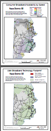
An example of a large rural district (H68): many communities are served at speeds higher than expected, however others still need progress.
The Utah Legislature has begun its 45 day 2013 General Session.
Utah’s broadband landscape is of strong interest to decision-makers, at all levels, as it plays an important and direct role with economy/jobs, education, energy, and many other cornerstone issues. For this reason, the Project has created 2 page overview maps*, depicting broadband service availability, for all State House and State Senate districts.
Senate Maps by District:
1 2 3 4 5 6 7 8 9 10 11 12 13 14 15 16 17 18 19 20 21 22 23 24 25 26 27 28 29
House Maps by District:
1 2 3 4 5 6 7 8 9 10 11 12 13 14 15 16 17 18 19 20 21 22 23 24 25 26 27 28 29 30 31 32 33 34 35 36 37 38 39 40 41 42 43 44 45 46 47 48 49 50 51 52 53 54 55 56 57 58 59 60 61 62 63 64 65 66 67 68 69 70 71 72 73 74 75
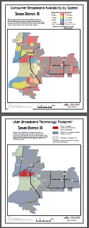
The maximum advertised consumer-level broadband speeds for all wireline-based services (cable, DSL, fiber) are shown, where available, as solid colors and wireless (mobile and Wi-Fi/WiMAX) services are shown, where available, for the remaining area using hatched colors. Warmer colors indicate faster speeds. Blues, purples, and blacks (excluding the major roads) are areas where substantial enhancements are likely needed.

An example of an urban district (S10)….Great speed but variation in fiber deployment means the highest end speeds (1 Gb +) have limited availability.
Page 2 Map: Broadband Technology Footprint (by District)
The highest order broadband technology (defined by speed and reliability) is shown. On the map, fiber-based services (red) take precedence where
they are available. Then, cable and/or DSL-based wired services (blue) are shown for areas without fiber. Green indicates areas where mobile and/or fixed wireless provide the only connectivity options.
Observations:
- Speed maps (page 1 for each district) for urban districts may initially indicate that the broadband landscape is somewhat uninteresting. In urban areas, some districts are served, more or less, entirely by 50 Mbps services and are colored entirely red indicating that businesses and consumers are likely well-served throughout the developed area. In these areas, the technology footprint (page 2) should also be of interest as fiber-based service will offer an even faster top speed of 1 Gbps versus 100 Mbps+ for DOCSIS 3.0 cable technologies. This difference represents a factor of 10 but speeds are currently well-more-than adequate in all but the most demanding use cases. DSL service tops out around 40 Mbps but varies, sometimes widely, by neighborhood-level implementation. In urban areas, the vibrancy of the broadband services market may be better understood by exploring, via the Project’s interactive map, the number of provider options at specific addresses or map locations. The presence of highest speed DSL service, fiber, or fixed wireless service, in addition to cable internet services in urban areas provides for more market competition which likely positively impacts both pricing and adoption.
- Speed maps (again, page 1 for each district) for rural districts show marked variety across the state. Many of the state’s most rural areas have 10-25 Mbps (yellow on the maps) or faster service within towns and cities. These demonstrate a great success story for the state, that is based largely on the foundation of the UEN and UDOT public-private partnership models and the ingenuity and dedication exhibited by most rural telecom providers. Several communities in the Southeast corner, West Central, and Northwest I-84 areas of Utah appear to be well-behind the pace set by other communities and the Project is actively looking to learn more about the dynamics in these areas.
- Wireless broadband service is the most dynamic part of the the State’s landscape. Speeds tend to be fast in the urban core, at a basic-level in many of the rural areas, and service is spotty, if available, in the much of the most isolated landscapes. Basic internet via satellite service is possible where the sky is visible at 40 degrees to the south but speeds just qualify under a very generous definition of broadband and have a high latency making the service not appropriate for interactive mediums such as video conferencing or web applications that exchange information with each keystroke, which has become common practice.
* All data represents service offerings as of Summer 2012 as voluntarily reported by individual broadband providers.
** Maps were created with Esri ArcMap software’s ‘data-driven pages’ automated map output tools. No (computer) mice were subjected to excessive cruelty or endangerment during map processing.