AGRC
December 2013 Map of the Month: Using Address Points in Broadband Verification
Utah received dedicated funding as part of the NTIA’s State Broadband Initiative to work in partnership with local government to…
December 4, 2013
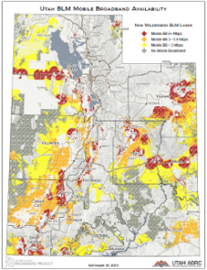
Sept 2013 Map of the Month: Mobile BB on USFS and BLM Land
Over 66% of Utah’s lands are owned and administered by the federal government and its agencies. Among the 50 states,…
September 19, 2013
Utah Telecom Boundaries Interactive Map
Using ArcGIS Online, a platform for building basic GIS-style interactive web maps, the Utah Broadband Project mapping team at the Automated Geographic Reference…
July 25, 2013
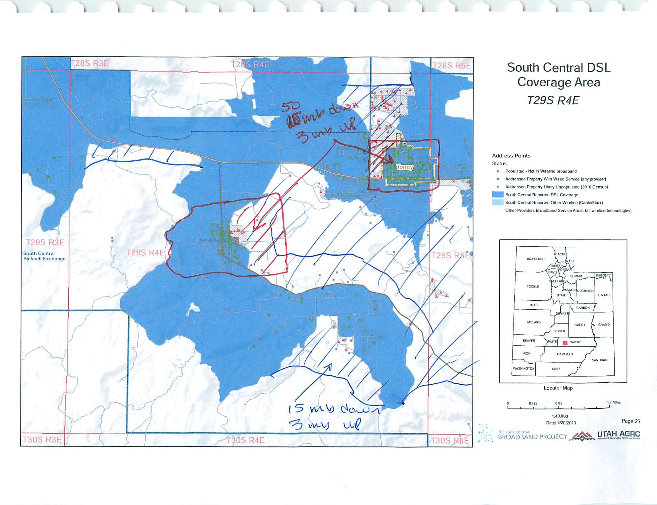
May 2013 Map of the Month: Speed-based Use Cases and Populated Areas
The Utah Broadband Project’s May 2013 map of the month displays Utah’s populated areas with broadband coverage areas for 3 different…
May 20, 2013
Spring 2013 Broadband Data Submission
The Utah Broadband Project works with 53 broadband providers in Utah twice a year to update Utah’s broadband mapping dataset. On…
April 12, 2013
Come see us at “Maps on the Hill” on 1-28-13
Maps on the Hill is this coming Monday, January 28, 2013 from 11:00am to 1:30pm in the Utah State Capitol…
January 25, 2013
"Media inquiries: Please contact the office's Public Information Officer, Ashley Okawa, at ashleyokawa@utah.gov or 801-518-3765."