GIS
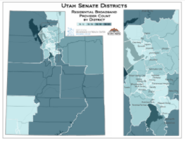
January Map of the Month: Residential Broadband Providers By Utah Legislative District
The 2018 general session of the Legislature kicks off on Monday, January 22nd so, our January 2018 Map of the…
January 16, 2018
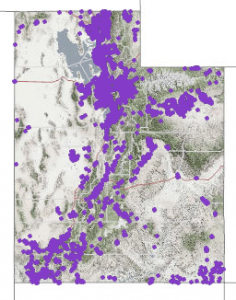
December Map of the Month: Utah’s Address Points, a Critical Digital Asset
Our December 2017 Map of the Month highlights Utah’s statewide “Address Point” map layer — a vital, statewide information asset.…
December 21, 2017
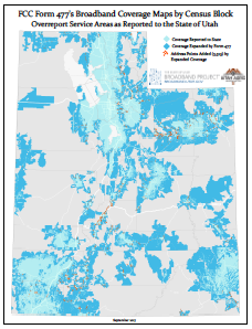
September 2017 Map of the Month: ‘Extra Coverage’ in the FCC Form 477 Broadband Maps
Our September map of the month revisits a topic that we explored in October of 2014 — how Utah’s broadband…
September 21, 2017
August 2017 Map of the Month: Fiber and Other Maps from UDOT’s UPlan Site
The August broadband map of the month is the collection of map data and viewers that comprise the UDOT UPlan…
August 30, 2017
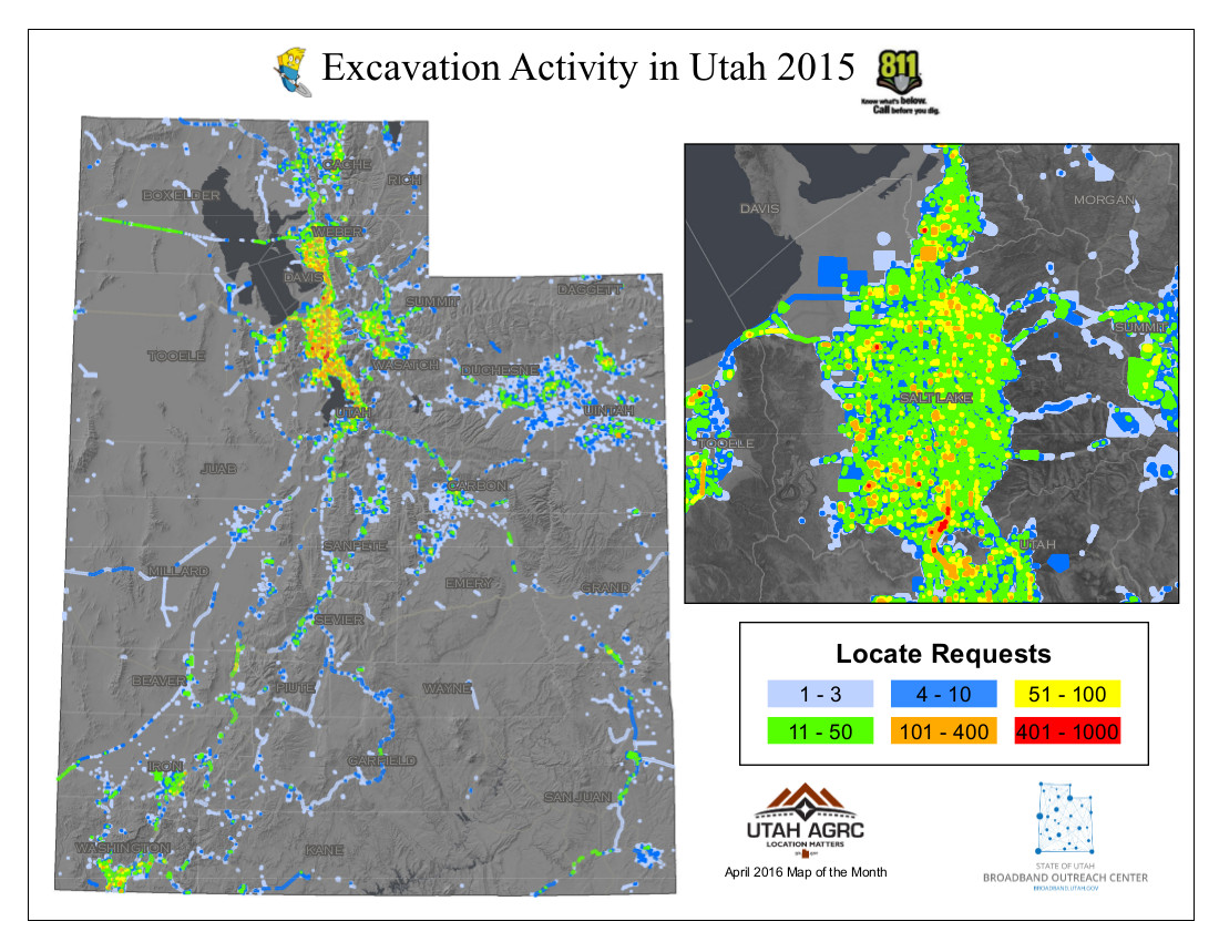
April 2016 Map of the Month: Blue Stakes, Call Before You Dig!
Planning to dig a hole or otherwise move the earth in Utah? It’s strongly in everyone’s interest, including your own,…
April 16, 2016
February 2016 MOTM: States’ FirstNet Coverage Objective Maps Released in RFP
The federal-level First Responder Network Authority (FirstNet) issued its Request for Proposals (RFP) for the deployment of the nationwide public safety broadband network on January 13.…
February 4, 2016
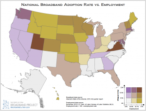
January 2016 Map of the Month: Broadband Access & Employment
Happy New Year and welcome to the first 2016 installment of the Broadband Outreach Center’s Map of the Month series.…
January 21, 2016
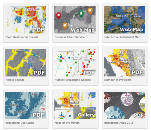
December 2015 Map of the Month: New Online Map Gallery
Since its inception in April 2012, over 40 maps have been published in the Utah Broadband Outreach Center‘s Map of…
December 23, 2015
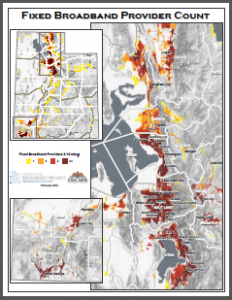
February 2014 Map of the Month: Number of Fixed Broadband Providers per Block
This month’s installment in our Map of the Month series looks at the number of broadband providers capable of providing…
February 21, 2014
Utah Telecom Boundaries Interactive Map
Using ArcGIS Online, a platform for building basic GIS-style interactive web maps, the Utah Broadband Project mapping team at the Automated Geographic Reference…
July 25, 2013
"Media inquiries: Please contact the office's Public Information Officer, Ashley Okawa, at ashleyokawa@utah.gov or 801-518-3765."