Map of the Month
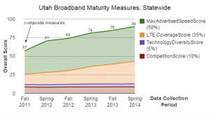
November 2014 “Map” of the Month: Maturity Scores Highlight Impressive Broadband Deployment Success
One of the important objectives of the Utah Broadband Project (UBP) has been to definitively portray Utah’s Broadband landscape. Gone are the…
December 1, 2014
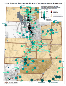
September 2014 Map of the Month: Utah’s Rural School Classification
Recently, the Federal Communications Commission (FCC) released an Order making reforms to the E-Rate program, which helps provide discounts to…
September 25, 2014
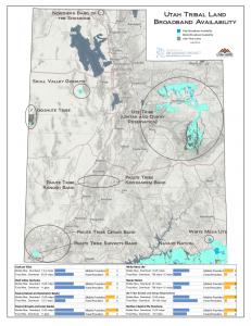
July 2014 Map of the Month: Broadband Availability on Tribal Land
On the whole, Utah has great broadband coverage, especially in urban areas. While Utah’s broadband coverage in comparison to similar states…
July 30, 2014
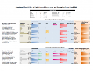
May 2014 Map of the Month: Broadband Availability at Utah’s Tourist Attractions
Summer is upon us, so for the May Map of the Month series, the Project’s mapping team analyzed broadband capabilities at Visitor Centers…
May 30, 2014
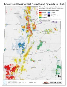
April 2014 Map of the Month: Utah Broadband Landscape at a Glance
Twice a year, the Utah Broadband Project updates the statewide broadband coverage map data. Utah’s latest update was submitted to…
April 17, 2014
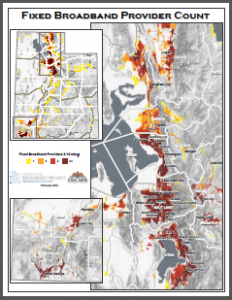
February 2014 Map of the Month: Number of Fixed Broadband Providers per Block
This month’s installment in our Map of the Month series looks at the number of broadband providers capable of providing…
February 21, 2014
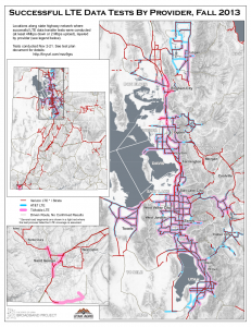
January Map of the Month: Preliminary Mobile Drive Test Results of LTE Service in Utah
After a competitive bid process, the Utah Broadband Project contracted with Isotrope, LLC to conduct a statewide mobile broadband drive…
January 21, 2014
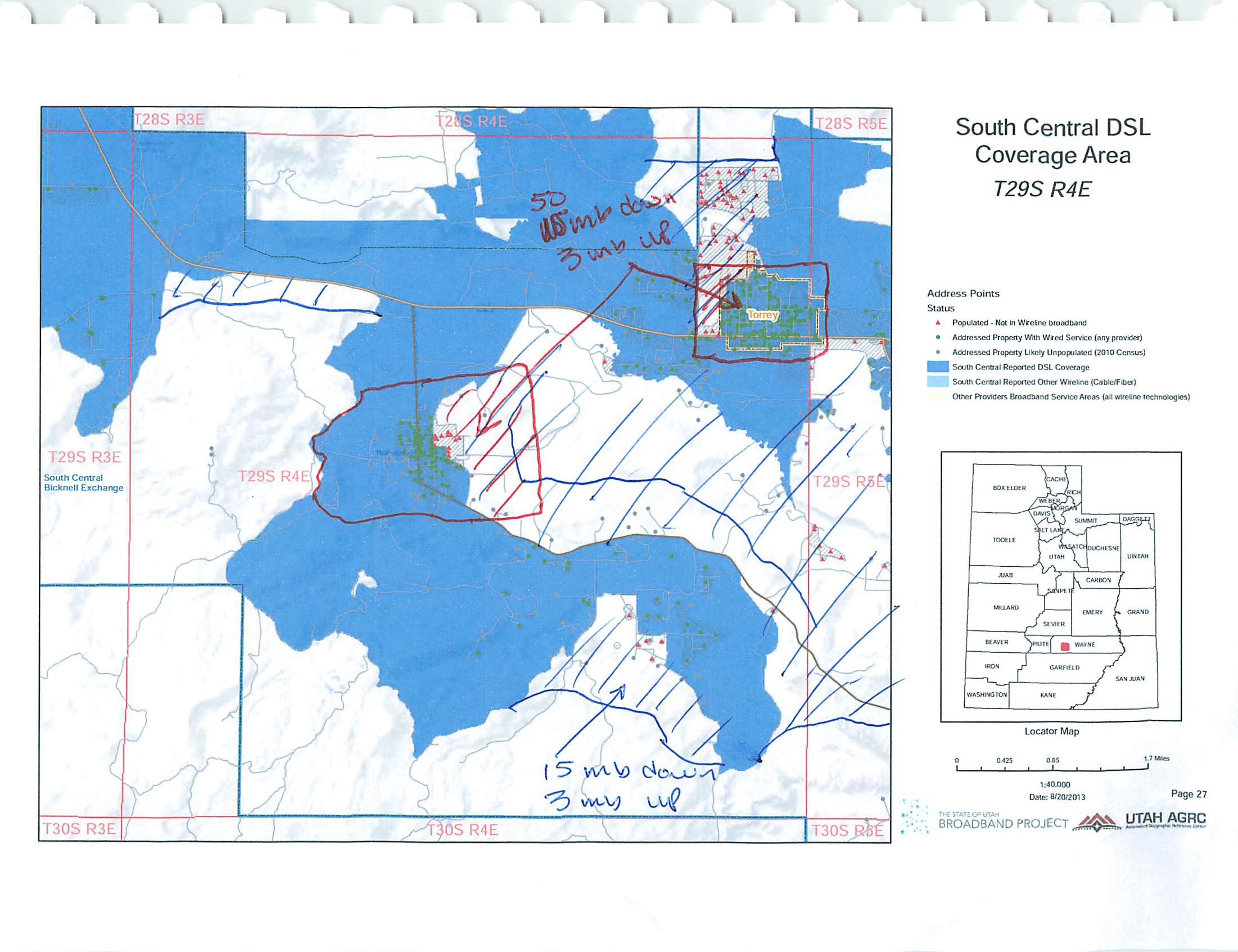
December 2013 Map of the Month: Using Address Points in Broadband Verification
Utah received dedicated funding as part of the NTIA’s State Broadband Initiative to work in partnership with local government to…
December 4, 2013
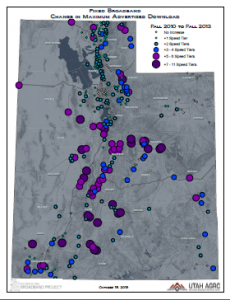
Oct 2013 Map of the Month: Utah’s Changing Broadband Landscape
This month the Project’s mapping team compared how advertised broadband speeds have changed since the beginning of the Utah Broadband…
October 16, 2013
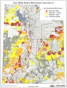
Sept 2013 Map of the Month: Mobile BB on USFS and BLM Land
Over 66% of Utah’s lands are owned and administered by the federal government and its agencies. Among the 50 states,…
September 19, 2013
"Media inquiries: Please contact the office's Public Information Officer, Ashley Okawa, at ashleyokawa@utah.gov or 801-518-3765."